
Ridge: Rocks & Springs
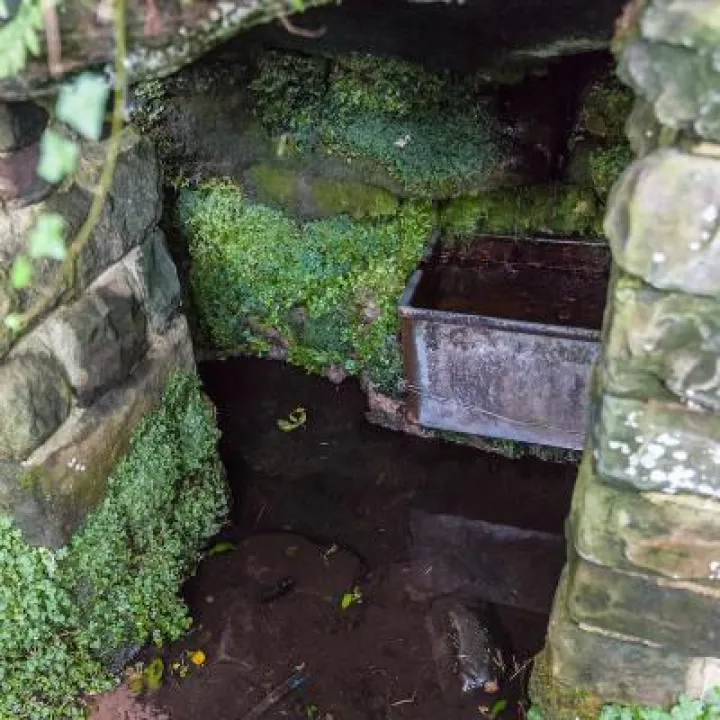
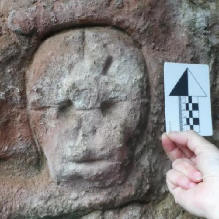
Over a period of three years from July 2014 to July 2017 the Sandstone Ridge Trust conducted a Heritage Lottery Funded project working with local volunteers to understand how the distinctive physical features of the Ridge have shaped the cultural heritage of the area, and specifically, how sandstone and water supplies, have enabled settlers, farmers and industrialists through the ages to develop and exploit their environment. The project focussed on sandstone quarries and methods of extraction, historic communal and commercial water supplies and rock art and carvings.
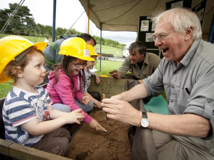
Approximately fifty volunteers were recruited for training workshops and many went on to participate actively in research and fieldwork. Training workshops were held on the Ridge's geology and hydrogeology, on rock art and graffiti, on documentary research, surveying, photography, use of aerial photographs and maps, and recording techniques. A Handbook describing the methods used in the Project was produced for the volunteers.
The first stage of the volunteers' research was to search the Ridge in order to identify as many sites of old quarries, wells and rock art/graffiti as possible. Through a combination of desk research at the County Archives and at home with on-line maps, followed up by site visits along the entire length of the Ridge, the volunteers identified and recorded more than 700 sites of old quarries, wells and water supplies and significant examples of graffiti and rock carvings. These can be viewed on the interactive map below.
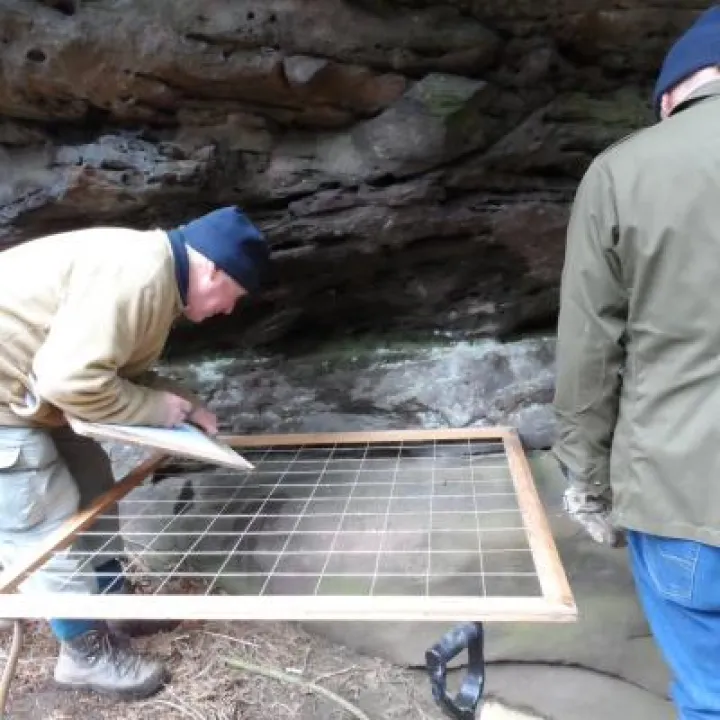
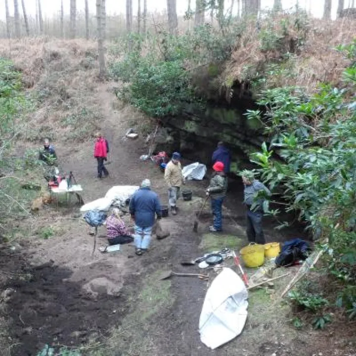
When the greater part of the first stage was completed the volunteers identified three sites that could be accessed for much more detailed two- or three-day surveys and excavations. These sites were at: Simmonds Hill Quarry, Manley, Urchin's Kitchen, Delamere, and Bloody Bones Cave, Harthill. Archaeological surveys were conducted there by volunteers over three weekends in 2016. A report is available of the excavation carried out at Urchin's Kitchen.
Finally, a 130-page A5 booklet was produced bringing together the knowledge acquired by the volunteers in a form that can be enjoyed by the general public. The book, which is free and available at libraries throughout Cheshire, has chapters on the geology of the Ridge, the quarrying of its stone, its wells and water supplies and the rock art and historical graffiti that can be found along its length. The book concludes with descriptions of nine easy country walks devised by the volunteers and featuring some of the interesting sites that they came across during their research.
The Trust can also offer further walks, talks and photographic displays about the project tailored to the needs of individual groups.
MAP(1ERQ-P36F8BA-RShdfmQJZKPUF2g)
The spread sheet (xml. file) used to generate the distribution map, containing the records produced by the RRS volunteers as part of the Stage One survey is available to download from HERE.

Sandstone Ridge Trust
Registered Company No. 7673603
Registered Charity No. 1144470
info@sandstoneridge.org.uk