
We Celebrate the 83rd Year of the 'Triangulation Pillar'
It might be the satisfaction in reaching a summit, or it might simply be the nostalgia that we attach to these instantly recognisable features of the landscape, but there is something that is quintessentially British about the much loved Ordnance Survey Triangulation Pillar.
'Triangulation' is basically a mathematical process that makes accurate map making possible.
Today, Thursday, 18 April 2019 is the 83rd Birthday of the 'Trig Pillar' which was regarded to be part of a state-of-the-art network, built to literally re-write the map of Britain.
The first Trig Pillar was installed back in 1936 in Cold Ashby, Northamptonshire, with the Mapping Agency of Ordnance Survey launching the 'Retriangulation of Great Britain'
Some 6500 trig pillars were used to measure the shape of the land and to rewrite the map of Britain.
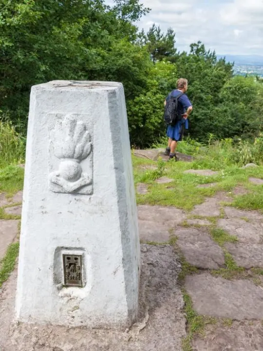
There are 2 accessible Trig Pillars on The Sandstone Ridge; one at 'Raw Head', the highest point on The Ridge at 227m (746ft) above sea level, and the other at 'Helsby Hill'.
And some light-hearted facts ....
- Trig Pillars are likened to icebergs .... there is more of the Trig Pillar below the surface than above it.
- The highest Trig Pillar in Britain sits on the top of Ben Nevis
- The lowest Trig Pillar sits on the banks of the River Ouse
- Bill Bryson's list of favourite British items in his 2015 book, 'The Road to Little Dribbling', includes reference to this monolithic wonder
- And, you would expect no less, 'Trig Pillars' have become a focus for 'spotters'. Known as 'Trig-Bagging', it is not unusual to see individuals travel across the countryside spotting and recording as many as they can!
Happy Walking on The Ridge everyone and enjoy 'bagging' our Trigs!
(our image is of the Trig Pillar at Raw Head)

Sandstone Ridge Trust
Registered Company No. 7673603
Registered Charity No. 1144470
info@sandstoneridge.org.uk