
Boundary Markers on the Cheshire Sandstone Ridge
Stone boundary markers form an important part of our our heritage and Trustees of the Cheshire Sandstone Ridge have been out and about on the Ridge photographing some of these rare features of our landscape.
Our thanks to David Hayns for his insights into some of the boundary stones to be found on the Ridge. He writes ...
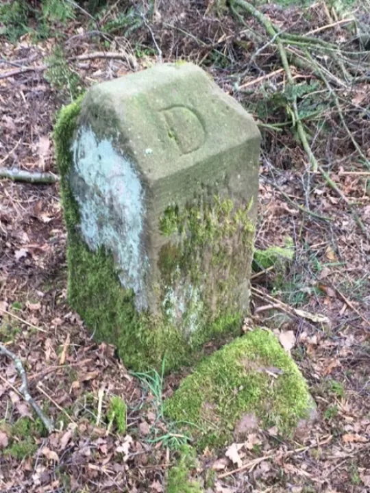
{Who erected boundary stones? Some are very ancient but others are of more recent origin, either as entirely new markers or as replacements for older ones. For many years I puzzled over the origin of a stone standing on Larkton Hill (OS Grid Ref. SJ 498.522).
The top of the stone is carved into two opposing diagonal faces, one bearing the letter 'D' for Duckington township, the other the letter 'L' for Larkton township ('township' being the pre-1894 name for what we now call a civil parish).
Some years ago during path restoration, work being undertaken by the late David Morris, the National Trust Warden, the next stone along the boundary was unearthed, with the added feature of the date '1839' carved into its top.
Later, during the course of my explorations of the Tyrwhitt-Drake papers in the Cheshire Record Office, I came across a receipted invoice dated April 1839. It was made out by G Pickren of Duckington, a local stone mason, to Mr Drake for '5 land marks between Duckington, Larkton and Bickerton – 10s'. Here was evidence that Mr Drake (known as 'Squire' Drake), one of the local landowners, had been instrumental in the erection of some of our township boundary markers.
The date of 1839 suggests that the Squire was making sure that his boundaries were clearly marked in preparation for the visits of the surveyors responsible for drawing up the Tithe Maps for Larkton and Duckington.
Since I discovered the first stone, the National Trust has had it moved from the small field where it stood originally to a new location just inside the adjacent woodland. Unfortunately the new site is not precisely on the actual township boundary, which could cause some problems in years to come. However, the residents of Duckington and Larkton are not noted for indulging in border disputes!
On lower land, township boundaries frequently follow natural or early man-made features such as streams, hedgerows and lanes. In the absence of similar features on open heathland, such as that on Larkton Hill, artificial boundaries had to be constructed. Therefore the continuation of the boundary, from Squire Drake's marker stones up to Maiden Castle Iron Age hillfort on top of the hill, is marked by a low sandstone dyke. Although
overgrown, the dyke can still be traced where it passes through the woodland. During the months when the bracken has died back it becomes quite prominent where it crosses the Maiden Castle enclosure, there marking the boundary between Duckington and Bickerton townships.
There used to be many more boundary stones on the hill. They are marked on the Bird's Hill enclosure plan, surveyed in 1854, and on early large-scale Ordnance Survey maps. There may still be some to be re-discovered by someone with the patience to search the civil parish boundaries, using the modern 1:25000 OS map (Explorer Map No.257).}
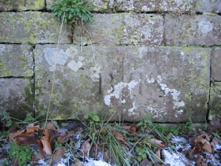
Our images show a boundary stone between Broxton and Tattenhall and also that referred to in the article by David Hayns between Duckington and Larkton.

Sandstone Ridge Trust
Registered Company No. 7673603
Registered Charity No. 1144470
info@sandstoneridge.org.uk